.png)

Honeydale From The Air!
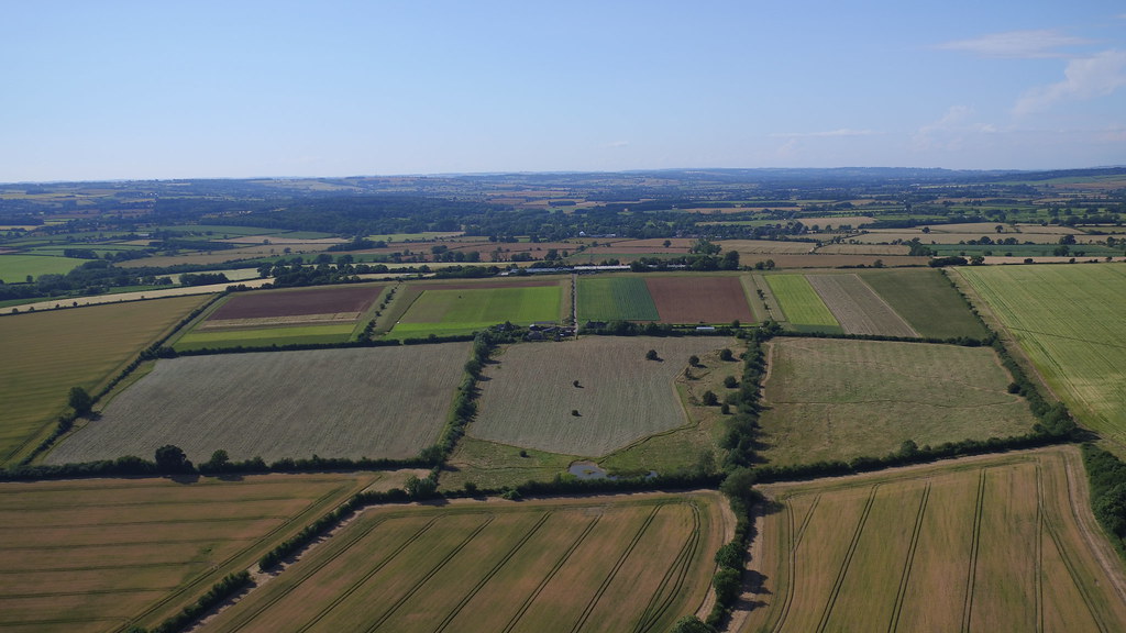
Is it a bird? Is it a plane? No, it’s a drone, which flew up and over Honeydale Farm last week with a camera attached. From an altitude of 500ft it captured some wonderful photography of the wintry fields and spectacularly displays the flood alleviation works, showing how the recent rainy weeks have resulted in water flowing down through the leaky dams to the holding pool at the bottom of the fields.
The darker brown strips in the four top fields are control plots of barley that we are reseeding every year to test the soil in order to monitor how we are improving it with various mixtures of green manures, cover crops and herbal leys on our other fields. It’s also great to see the newly planted Heritage Orchard (the white dots to the right of the photo) from this perspective. Our beehives are also visible to the right of the farm buildings. We hope to be able to send the drone up again over the coming months to show how the farm changes over the seasons.


0 comments: